
This turned out an exciting evening which I would place among my most memorable convective events of the Summer due to the pure visual treat I experienced, however at the time I was not pleased by the way in which my images turned out so I decided that I was not going to do an account, or even post images anyway on the forums I frequent. I did add a few of them at a larger size on the 'Sky Events' page and got several interesting responses from others in N. Ireland who seen the storms from different locations. It was only during the month of August that I had another look at the images, and they have grown on me so I decided to go ahead with this image report against my better judgment. It was one of those events when images just don't do justice to what could be seen with the naked eye, however since I had such an exciting experience it would be a shame not to include it as a permanent page in the 2009 storm section. So here it is.
My memory was a little fuzzy on the atmospheric set-up for this day so I had to do some research back in time to relocate the convective outlook issued for that time, then it all came flooding back. ESTOEX had a thunderstorm box over all of Ireland with much of the country highlighted in a level 1 box for excessive precipitation from slow moving storms with a risk of flooding and landspouts. There was something like 900-1000 CAPE with LI at -2 or -3 with strong solar heating in a slack Sly flow with at least the first 3km of the atmosphere sporting strong instability along with some directional shear for rotating updraughts and storm organization. Of note where the numerous convergence zones and troughs crossing the country. There was a risk of even stronger convection and funnel clouds in the Republic of Ireland. GFS kept the highly unstable air present over both Ireland and N. Ireland straight through into the late evening so it looked to be a promising day with strong thunderstorms and heavy showers.
From my home town of Maghera in central Ulster, N. Ireland success at arrived early. During the afternoon a storm passed through to the N however it was not what one would call photogenic, just a large convective mess with three loud rumbles, I couldn't see the lightning at the time though. Things went quiet after this and I thought the day was a bust although I still felt optimistic about later. By early evening I had just finished my dinner and decided to check the Met office radar. Large storms covering a wide area where producing plenty of sferics to my S and moving slowly N. Judging by their track on radar they would pass by Maghera miles away to the W over the Sperrins so I thought if I could get to a high vantage point I might be able to see them from here. So I went out to the best elevated vantage point in the country and it wasn't look before I could see those distant storm clusters approaching. I set the camera up in a field, however the Cows where not very friendly today with the largest one taking an extreme interest in what I was doing, it didn't like what it saw and began giving me dirty looks, eventually it began making aggressive straight line trots at me, I wasn't going to take any chances, there where people killed in N. Ireland not so long ago from angry Cows and Bulls so I grabbed the camera and flicked over a rickety barbed wire fence. This was just in time because the Cow had charged at me just as I made the move, it wasn't happy I had escaped and began trying to knock the fence post down with it's head which really unsettled me. I turned my back to it and calmed down, set up the camera again and stayed quiet hoping the Cow would not see me as a threat and loose interest. This eventually worked so it rejoined the herd and together they munched on grass while occasionally showing me a weary eye.
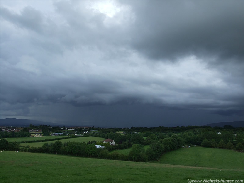 |
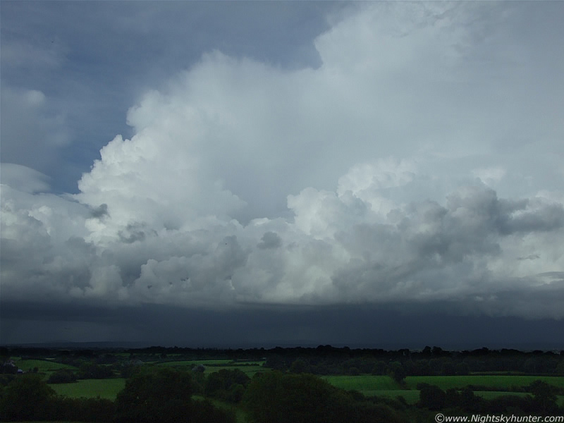
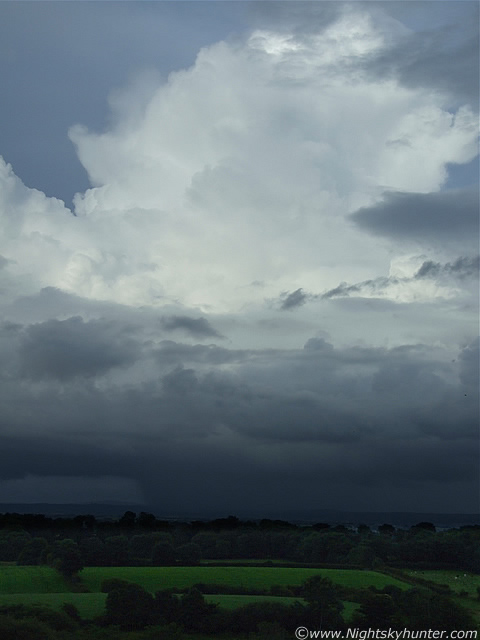
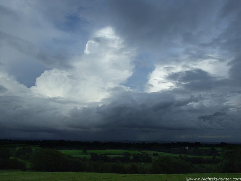
Nothing is ever straight forward, I just wanted to photograph storms from a peaceful location away from people and now the animals were protesting. I just blended into my environment and stayed quiet. Eventually harmony returned to the area, the Cows and Sheep were at ease and Rabbits darted across the fields. I had been accepted at last. My theory had been correct about the motion of the storms, they did indeed pass through the W sector of Maghera over the Sperrin Mountains and extended for miles in that direction. The above image is looking W, facing the E side of those huge storm clusters. The storm is moving from L to R extremely slowly and covered a large area in azimuth when it first appeared, from S to NE. I took about 40 images of it during the that period, in fact it was so slow that it seemed stationary at one stage so I was able to sit on the grass and just admire it in the warm humid air in complete comfort. The side 'wall' which covered it's E flank can be seen, and above, is a thick band of mid level cloud which hid the main structure. Above this, in the occasional gaps, I could see the huge white updraught towers and anvil canopy. Below was a very dark precip core of moderate strength. I couldn't see any lightning or hear thunder because all of the action was taking place on the far side of the precip which the sferics charts confirmed at the time. I was not bothered by this because at least I was seeing a storm, I spent a long time watching for funnels however the storm seemed to be behaving itself on this side so I just watched feeling in a lazy mood. It moved N producing regular lightning for miles (according to the sferics charts).
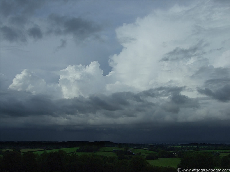
My location provided me with a great view of the entire W dome of the sky, however behind me tall trees blocked the entire E dome although I could tell that the sky was clear and blue in that area from what I could see at the zenith so I didn't pay much attention to that area. Some time later I spotted a guy about half a mile away who was standing on a path seemingly fixated by something in the sky. This really caught my attention because most people here are so switched off when it comes to the sky. He was just standing there staring to the E, I was thinking ''what on Earth is he looking at, is there something going on that I don't know about?''. So with the trees blocking my view I walk away from the small forest until I could see the top half of the E sky. When I looked in that direction I almost went into shock. Gigantic convection was dominating the entire sky in that direction, and because it was in the E with a lowering Sun in the W, the convection was the most remarkable bright white colour. It was a stunning sight with power wrote all over it. I mentally kicked myself for watching one section of the sky for so long while ignoring the rest, there could have been a tornado from those cells and I wouldn't even have known about. I promised myself I would never make that mistake again.
With panic setting in, and feeling the rush of excitement, I needed to find a better location, so I ran through the field of Cows, only this time I didn't care if they were angry or not, I was focused on a new target and was going to get it no matter what. I had to run across several fields, navigate over two barbed wire fences between a deep gully, then found the place I wanted which was an elevated field with the perfect view from SE to N. I was out of breath and panting, while overheating and sweating like crazy so I threw my jacket on the ground and set-up the camera on the tripod while sweat stung my eyes.
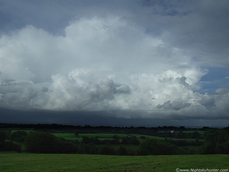 |
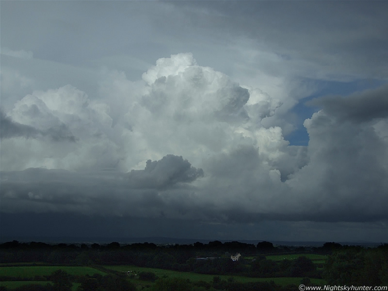
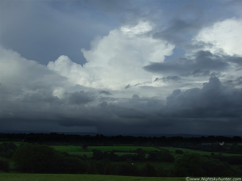
Images don't do this scene justice so I will describe the view with words. An obvious convergence zone was evident and on it was a train of powerful multicells arranged nose to nose on a bold line extending from SE to N. The line was extremely slow moving, almost stationary, with a multitude of incredible towering cumulus and cbs with anvils all interacting with one another. They were enormous in size with solid profile and crisp tops displaying rapid upward motion. You cannot appreciate how large this convective line was by looking at the images. These where many miles away to the E with the camera slightly zoomed in to isolate certain groups which got my attention. The line extends out of the frame far on both sides. Moving R to L.
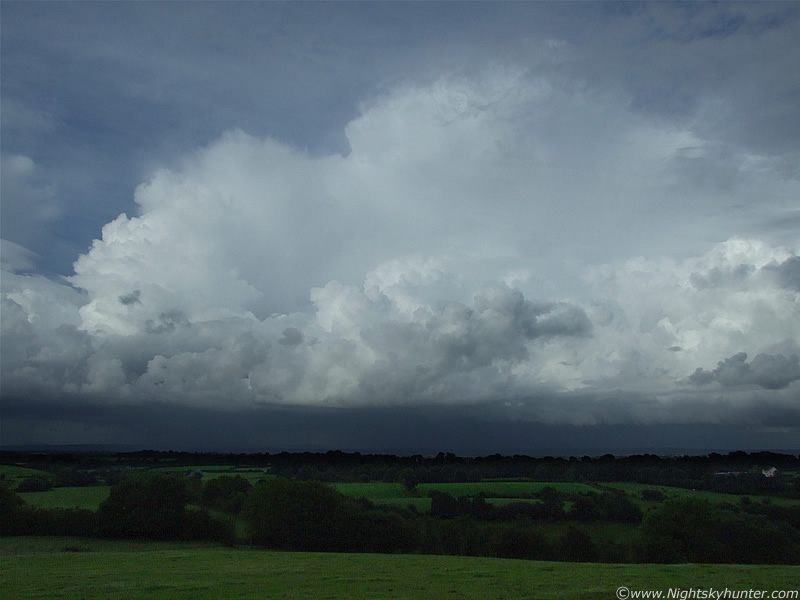 |
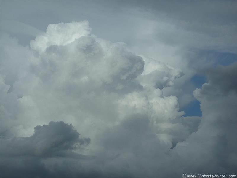
The front of the multicell I zoomed in on. Cumulonimbus (cb) cells in the background with chunky anvils and rock solid updraughts at the flank and sides of the larger cells. Getting images was a nightmare because the convection was so bright and white, it was easy to overexpose these so I had to stop the aperture down to F/7.1 and use very fast shutter speeds. Since it was before sunset the fields where getting dark below, with the area directly below the cells being extremely dark. It was difficult trying to expose for this.
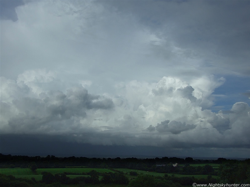 |
Same cell only concentrating on the centre and flank. Erupting towers going up at the rear taking advantage of the late evening Sun and instability. To get a sense of size compare with the white house below. The large anvil seen side-on even extends out of the frame to the upper L. In reality everything visible here was absolutely solid/crisp and sharp indicating powerful updraughts. After firing off many images I eventually caught my breath and got a chance to study the entire line. There was so much to look at. At this time there were reports of a massive cell with lightning over Portrush on the N coast of N. Ireland, and I could actually see it from here in Maghera!. It looked crazy in that direction with the cells behind it producing outflow scud which looked to be touching the ground.
 |
Leading edge of the my favored multicell. Light precip falling under the cbs. There where probably rumbles in there but I couldn't hear them from this distance.
 |
Zooming into the flank of the anvil with lively convective towers in the foreground. To my L (NE) some of the anvils died, turned fuzzy and became orphans. When this happened new updraughts would sprout up and develop a fresh anvil and the entire cycle would repeat itself again like a well oiled machine.
 |
Explosive convection
 |
Panning the camera NE to another section of the line with more anvils and new updraughts. I was sure the chances of a funnel cloud or weak tornado from this line were good. No sooner had I thought this when a funnel cloud formed under the tower to the LOC. Actually it formed from the rear of the tower on my side, it was white in colour and extremely thin like a rope with several bends. It was the most slender funnel I had ever seen and could be seen rotating despite it's distance from me. It disappeared before I could get the camera zoomed in so it was a short-lived event. Nothing spectacular, but still a funnel. There was every chance that more could drop from anywhere on this line.
 |
Back to the E and dead centre within the line was this fresh cb with strong young anvil with mammatus on the rear. Below it a dark precip core began to fall and became quite intense.
 |
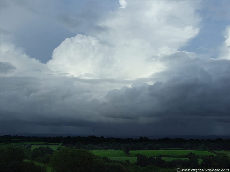
Wider shot of the same line. There was probably a few rumbles going on under there too. Lighter precip breaking out to the L and R also. These cells where stacking up one behind the other.
 |
The central updraught on that cb shot up explosively to a tremendous height, I couldn't believe how high it was. Not only that but stronger winds aloft (wind shear) where beginning to tilt the updraught. Check out the two pileus caps on the twin mounds on top.
 |
Visually, this was a stunning sight. The tilt of the main updraught is now very pronounced. Always a good sign for organization and potential for severe weather. Note the dark lowering, this is when accessory cloud classification became a problem. Was this a inflow-feature from the tower on the L or an outflow feature from the main cell to the R?. Furthermore, was it an inflow feature from the tilted updraught from the cell to the R?. With cells touching each other like this with precip falling everywhere it was difficult to be sure. Had this cell been on it's own then identification would have been easy.
 |
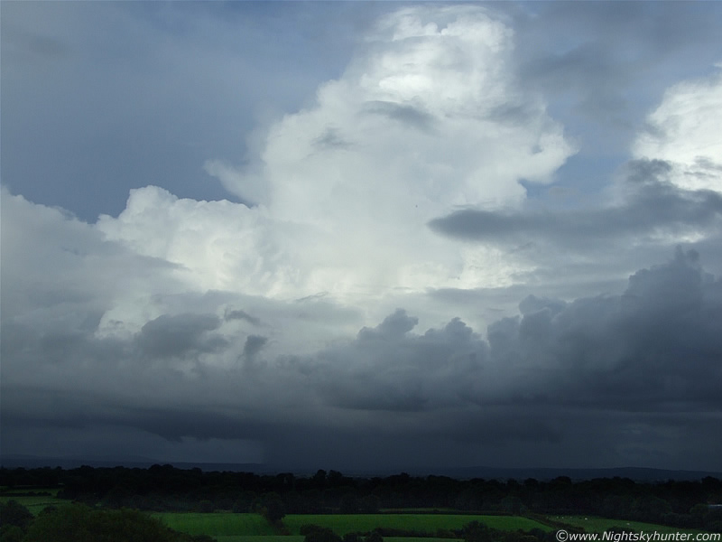
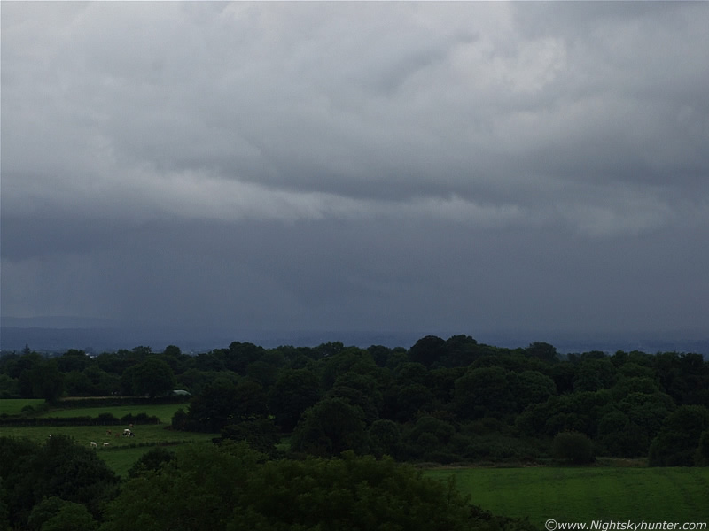
Going wide again showing the two main cells at the centre of the line. Mid level cloud is obscuring the high tops. Please excuse these poor quality images, I was having a tough evening trying to capture these, and with light levels getting low it became even more difficult. The Sun was behind the trees at my rear and not visible in the sky but obviously still above the horizon.
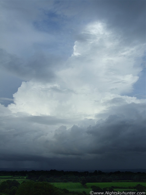 |
I actually like this vertical/portrait capture because it conveys the vertical extent of this huge updraught. Convective tops where in excess of 32,000ft on this day. Look back again at the horizontal image above this one. Those two large cells then merged together to cause a complicated outflow/inflow scene Then a very interesting lowering appeared.
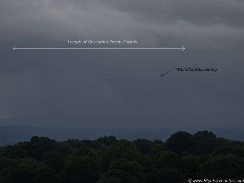 |
This is one of many 300mm captures I made of the most spectacular lowering of the evening in that dark area under the merged cells. A very large dark lowering formed, developed an inverted cone-shaped profile with very smooth sides held directly under what I believe was the main inflow area. It is visible behind (E of) that foreground precipitation curtain which slightly obscured the view. I watched this lowering for 15 - 20 min's as it exhibited strong motion, although rotation was not evident from this distance. It went extremely close to the ground so I was entertaining the possibility that this could have been a large funnel or even brief tornado. After all, the condensation funnel does not need to be seen going all the way down for the invisible vortex to be on the ground. I wondered if there was a disturbance on the ground although I couldn't see any debris cloud or dirt getting kicked up. I was trying to figure out what it was, since it had the behavior of an inflow feature I suspected it was at the very least a wall cloud.
I was hoping there was someone else in N. Ireland interested in storms watching this who could provide some help. As it turns out there was, Declan O' Doherty from Maghera is also a storm photographer and on that day he too was out watching this powerful line. He observed the same thing I did (along with many other lowerings) and confirmed that he didn't see a touch down either which was very helpful. To help confirm the feature I asked famous storm chaser Mike Hollingshead from Nebraska, USA for help. He looked at the images and in his opinion he said it was at least a wall cloud, actually this is what he said...
''I'm picky on what one calls a wall cloud as many will call any old lowering under an updraft a wall cloud. Probably a wall cloud at least as it looked right/upright at first then you can see how it then gets undercut by cool air. Updraft takes in good air at first, get a nice wall cloud which should be an inflow dominant feature not outflow dominant....then it evidently dumps the core it has created and pushes out the lowering. Hard to say much about the brief pointy thing as it was a wall cloud. I never try to get too caught up in being able to label things, as regardless of the name or category it was the same visual entity at the time and that is all that matters.''...thanks very much for your help Mike.
 |
Excuse this badly taken image. Precip core dumping to the L and wall cloud/lowering to the R of it. There are two horizontal bending strips of dark cloud to the R of the lowering which could be a number of things. Just inflow cloud, possibly a tail cloud, or even a slim funnel lifted into a horizontal position. Being so far away I doubt I will never know. I would love to have been up close to that lowering for a better look. After this the lowering became slender in shape and lifted up along the base exactly as Mike described (I have images of this) when the precip core undercuts the lowering, then it seemed to fade away.
It had been an interesting evening, and with the land turning dark and cool I decided to head home. At dusk a gust front arrived bringing moderate rainfall then during evening twilight I could still see huge updraught towers black against the sky with stars above the tops. I was amazed they had such energy at this time of the night with no solar heating.
Here's a short video clip showing some of the multicell convection in that line. Nothing exciting however it does show the structure very well. You can see how peaceful it was from my location with the birds singing in the trees and not even a breeze against the speakers.
This was definitely an evening to remember. Both Declan and I agreed that the quality of the convection was stunning. He also got many great images, it's a pity I did such a bad job with my own. I wish I could go back in time and try it again, there will be other chances in the future though. Thanks for reading.
Martin McKenna